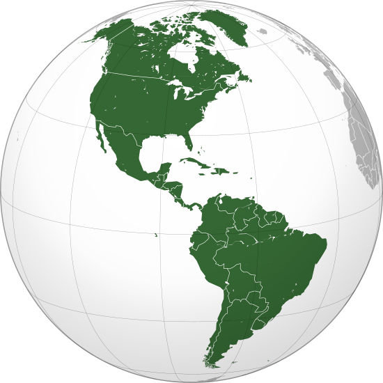
Fichier:Americas (orthographic projection).svg

Taille de cet aperçu PNG pour ce fichier SVG : 550 × 550 pixels. Eutes résolucions : 240 × 240 pixels | 480 × 480 pixels | 768 × 768 pixels | 1 024 × 1 024 pixels | 2 048 × 2 048 pixels.
Fichier d’origine (Fichié SVG, résoluchon éd 550 × 550 picsels, diminchon: 332 kio)
Résumè
| Décripchon | Orthographic map of the Americas with national borders added |
| Date | |
| Source | Traval parsonnel |
| Auteu | Martin23230 |
| Autres versions |
.svg) |
| SVG information | Le code de ce fichier SVG n'est pas valide en raison de 98 erreurs. |
.svg)
.svg)
.svg)
.svg)
.svg)
.svg)
.svg)
.svg)
.svg)
.svg)
.svg)
.svg)
.svg)
.svg)
.svg)
.svg)
.svg)
.svg)
.svg)
.svg)
.svg)
.svg)
.svg)
.svg)
.svg)
.svg)
.svg)
.svg)
.svg)
.svg)
.svg)
.svg)
.svg)
.svg)
.svg)
.svg)
.svg)
.svg)
.svg)
.svg)
.svg)
.svg)
.svg)
.svg)
.svg)
.svg)
.svg)
.svg)
.svg)
.svg)
.svg)
.svg)
.svg)
.svg)
.svg)
.svg)
.svg)
.svg)
.svg)
.svg)
.svg)
.svg)
.svg)
.svg)
.svg)
.svg)
.svg)
.svg)
.svg)
.svg)
.svg)
.svg)
.svg)

.svg)

.svg)

.svg)
.svg)
.svg)
.svg)
.svg)
.svg)
.svg)


.svg)
.svg)
.svg)
.svg)
.svg)
.svg)
.svg)

.svg)
.svg)
.svg)
.svg)
.svg)
.svg)
.svg)
.svg)
.svg)

.svg)
.svg)
.svg)
.svg)
.svg)
.svg)
.svg)
_without_national_boundaries.svg)
.svg)
.svg)
.svg)
.svg)
.svg)
.svg)

.svg)
.svg)
.png)
.svg)
.svg)
.svg)
.svg)

.svg)
.svg)
.svg)
.svg)
.svg)
.svg)
.svg)
.svg)
.svg)
.svg)
.svg)

.svg)
.svg)
.svg)
.svg)
.svg)
.svg)
.svg)
.svg)
.svg)

.svg)
.svg)

.svg)
.svg)
.svg)
.svg)
.svg)
.svg)
.svg)
.svg)
.svg)
.svg)
.svg)
.svg)
.svg)
.svg)
.svg)
.svg)
.svg)
.svg)
.svg)
.svg)
.svg)
.svg)
.svg)
.svg)
.svg)
.svg)
.svg)
_-_Crimea_disputed.svg)
.svg)
.svg)
.svg)
.svg)
.svg)
.svg)
.svg)
.svg)
.svg)
.svg)
.svg)
_political.svg)
.svg)
.svg)
.svg)
.svg)
_-_Crimea_disputed_-_no_borders.svg)
.svg)
.svg)
.svg)
.svg)
.svg)
.svg)
.svg)
.svg)
.svg)
.svg)
.svg)

.svg)
.svg)
.svg)

.png)
.svg)
.svg)
.svg)
.svg)
.svg)
.svg)
.svg)
.svg)
.svg)
.svg)
.svg)
.svg)
.svg)
.svg)
.svg)
.svg)
.svg)
.svg)
.svg)
.svg)
.svg)
.svg)
.svg)
.svg)
.svg)
.svg)
.svg)
.svg)
.svg)
.svg)
.svg)
.svg)
.svg)
.svg)
.png)
.svg)
.svg)
.svg)
_(orthographic_projection).png)
.svg)
Licince
Moi, en tant que détenteur des droits d’auteur sur cette œuvre, je la publie sous les licences suivantes :
Ech fichié-lo il est disponibe slon chés térmes del licince Creative Commons Attribucion - Partage dins chés meumes Conditions 3.0 (poin transposée).
- Os ètes libe :
- éd partager – éd copier, distribuer pi transmète chole euve
- d’adapter – éd modifier chole euve
- Dsous chés condicions suivantes :
- patérnitè – Os d'vez donner chés informacions appropriées concernant l'auteu, fournir un loyen vers el licince, et indiquer si des modificacions ont tè foaites. Os povez foaire cha pèr tout moéyin raisonnabe, mais poin d'eune manière qui suggérerait qu’il vos soutienne o approuve l'utilisacion éq vos in foaites.
- partage à l’idintique – Si os modifiez, transformez, o os basez édseur chole euve, os d'vez distribuer vote contérbuchon dsous el meume licince o eune licince compatibe aveuc chole éd l'original.

|
Os avez l' pérmission d' copier, distribuer pi modifier chol documint slon chés térmes del GNU Free Documentation License vérsion 1.2 obin toute vérsion ultérieure publièe pèr el Free Software Foundation, sans sékcions inaltérabes, sans teske d' prumière pache d' couvérture pi sans teske ed darène pache d' couvérture. Un egzimploère del licince est inclus dins l' sékcion intitulée GNU Free Documentation License. |
Vous pouvez choisir l’une de ces licences.
Histoère dech fichié
Buke su eune date/heure pou vir ch'fichié conme il étoait ach momint-lo.
| Date/Tans | Tiote image | Diminsions | Uzeu | Fichié éd chés conmints | |
|---|---|---|---|---|---|
| courant | 18 ed Juillet 2016 à 22:24 | | 550 × 550 (332 kio) | Turnless | Reverted to version as of 04:48, 5 December 2009 (UTC) Hawaii is in Oceania |
| 30 d'Avri 2013 à 02:05 |  | 550 × 550 (1,44 Mio) | Giggette | Centered | |
| 5 ed Déchimbe 2009 à 04:48 |  | 550 × 550 (332 kio) | Keepscases | borders | |
| 16 d'Aout 2009 à 11:26 |  | 541 × 541 (332 kio) | Bosonic dressing | tweak map: colour St. Lawrence Island (Alaska, USA), draw in missing peripheral latitudinal lines | |
| 26 ed Join 2009 à 16:20 |  | 541 × 541 (318 kio) | Martin23230 | {{Information |Description= Orthographic map of the Americas |Source=self-made |Date=2009-06-26 |Author= Martin23230 |Permission= |other_versions= }} Category:Orthographic projections Category:Maps of the Americas |
Usage dech fichié
Chés 2 paches d'apreu sont loyées à ch'fichié-lo :
Usage global du fichier
Chés eutes wikis suivants uzette chole fichier :
- Utilisacion édseur ab.wikipedia.org
- Utilisacion édseur af.wikipedia.org
- Utilisacion édseur am.wikipedia.org
- Utilisacion édseur an.wikipedia.org
- Utilisacion édseur ar.wikipedia.org
- الولايات المتحدة
- عالم غربي
- هندوراس
- فنزويلا
- شعراء المهجر
- آسيا
- أوروبا
- قارة
- تصنيف:قارات
- البرازيل
- المكسيك
- كندا
- الأرجنتين
- تصنيف:كوبا
- تصنيف:أمريكا الشمالية
- سيمون بوليفار
- برمودا
- تصنيف:أمريكا الجنوبية
- تصنيف:أرجنتينيون
- المحيط الهادئ
- أستراليا
- القارة القطبية الجنوبية
- كوبا
- بليز
- تصنيف:دول أمريكا
- تصنيف:مدن أمريكية
- اللغة الإسبانية
- تصنيف:دول الكاريبي
- أوقيانوسيا
- تصنيف:أنهار أمريكا الجنوبية
- بوليفيا
- بيرو
Vir davantage édseur l’utilisacion globale éd chole fichié-lo.
.svg)
.svg)