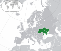
Fichier:Europe-Ukraine.svg

Taille de cet aperçu PNG pour ce fichier SVG : 713 × 600 pixels. Eutes résolucions : 285 × 240 pixels | 571 × 480 pixels | 913 × 768 pixels | 1 218 × 1 024 pixels | 2 435 × 2 048 pixels | 2 045 × 1 720 pixels.
Fichier d’origine (Fichié SVG, résoluchon éd 2 045 × 1 720 picsels, diminchon: 7,33 Mio)
Histoère dech fichié
Buke su eune date/heure pou vir ch'fichié conme il étoait ach momint-lo.
| Date/Tans | Tiote image | Diminsions | Uzeu | Fichié éd chés conmints | |
|---|---|---|---|---|---|
| courant | 12 ed Déchimbe 2022 à 17:19 |  | 2 045 × 1 720 (7,33 Mio) | Alexassandro | Reverted to version as of 14:22, 11 August 2015 (UTC) |
| 10 ed Marche 2017 à 01:18 |  | 2 045 × 1 720 (7,34 Mio) | Geom10 | fixed disputed borders | |
| 11 d'Aout 2015 à 14:22 |  | 2 045 × 1 720 (7,33 Mio) | Seryo93 | border is suitable for uncontrolled-territory variant | |
| 11 d'Aout 2015 à 08:29 |  | 2 045 × 1 720 (7,33 Mio) | Seryo93 | Second attempt at uploading | |
| 11 d'Aout 2015 à 08:24 |  | 2 045 × 1 720 (7,33 Mio) | Seryo93 | Isthmus of Perekop was too wide. Updated to match File:Europe-Ukraine (disputed territory).svg (except colour, of course) | |
| 19 ed Marche 2014 à 16:03 |  | 2 045 × 1 720 (2,7 Mio) | A.Savin | Reverted to pre-editwar state | |
| 18 ed Marche 2014 à 20:06 |  | 2 045 × 1 720 (2,71 Mio) | Артур михайлович | Reverted to version as of 17:05, 18 March 2014 | |
| 18 ed Marche 2014 à 17:06 |  | 2 045 × 1 720 (2,71 Mio) | Misha motsniy | по примеру с оккупироваными териториями Грузии и Кипра | |
| 18 ed Marche 2014 à 17:05 |  | 2 045 × 1 720 (2,71 Mio) | Misha motsniy | по примеру с оккупироваными териториями Грузии и Кипра | |
| 18 ed Marche 2014 à 17:04 |  | 2 045 × 1 720 (2,71 Mio) | Misha motsniy | по примеру с оккупироваными териториями Грузии и Кипра |
Usage dech fichié
Autchune pache n'est loïée aveuc ch'fichié-lo
Usage global du fichier
Chés eutes wikis suivants uzette chole fichier :
- Utilisacion édseur bbc.wikipedia.org
- Utilisacion édseur be-tarask.wikipedia.org
- Utilisacion édseur be.wikipedia.org
- Utilisacion édseur da.wikipedia.org
- Utilisacion édseur dsb.wikipedia.org
- Utilisacion édseur en.wikipedia.org
- List of companies of Ukraine
- LGBTQ rights in Ukraine
- History of the Jews in Ukraine
- List of sovereign states and dependent territories in Europe
- Post-Soviet transition in Ukraine
- Talk:Russia/Archive 8
- Wikipedia:Graphics Lab/Illustration workshop/Archive/May 2014
- Talk:Ukraine/Archive 5
- User:Falcaorib/Ukraine
- Utilisacion édseur fi.wikipedia.org
- Utilisacion édseur ja.wikipedia.org
- Utilisacion édseur ka.wikipedia.org
- Utilisacion édseur lt.wikipedia.org
- Utilisacion édseur lv.wikipedia.org
- Utilisacion édseur mk.wikipedia.org
Vir davantage édseur l’utilisacion globale éd chole fichié-lo.
