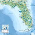
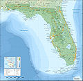
Fichier:Florida topographic map-fr.svg

Fichier d’origine(Fichié SVG, résoluchon éd 2 890 × 2 810 picsels, diminchon: 2,51 Mio)

Ch'fichié i vient éd Wikimedia Commons. I put ète uzé pèr d’eutes prodjés. Vir l'pache édseur Commons.

Résumè

Décripchon
English: Topographic map of the State of Florida, USA (2000 Census).
Note: the background map is a raster image embedded in the SVG file.
Français : Carte topographique de l'état de Floride, États-Unis (recensement 2000).
Note : le fond de carte est une image bitmap embarquée dans le fichier SVG.

Albers equal area projection; NAD83 (Florida HPGN) datum

Topographic scale: 1:1,200,000 (precision: 300 m)
Date
Source

Traval parsonnel

  • Sources of data:
    • Topography and bathymetry: NGDC Coastal Relief Model completed with ETOPO1 (public domain);
    • GSHHS (public domain);
    • Public domain data provided by the National Atlas of the United States of America and VMap-0;
  • Icons of the Interstate highways: File:I-4.svg, File:I-10.svg, File:I-65.svg, File:I-75.svg and File:I-95.svg released in public domain by Ltljltlj;
Auteu Eric Gaba (Sting - fr:Sting)
Pérmission
(Réutilisacion éd chole fichier)
Attribution and Share-Alike required
Autres versions

[éditer]

Translate this file This SVG file contains embedded text that can be translated into your language, using any capable SVG editor, text editor or the SVG Translate tool. For more information see: About translating SVG files.

Licince

Moi, en tant que détenteur des droits d’auteur sur cette œuvre, je la publie sous les licences suivantes :
GNU head Os avez l' pérmission d' copier, distribuer pi modifier chol documint slon chés térmes del GNU Free Documentation License vérsion 1.2 obin toute vérsion ultérieure publièe pèr el Free Software Foundation, sans sékcions inaltérabes, sans teske d' prumière pache d' couvérture pi sans teske ed darène pache d' couvérture. Un egzimploère del licince est inclus dins l' sékcion intitulée GNU Free Documentation License.
w:fr:Creative Commons
patérnitè partage à l’idintique
This file is licensed under the Creative Commons Attribution-Share Alike 4.0 International, 3.0 Unported, 2.5 Generic, 2.0 Generic and 1.0 Generic license.
Os ètes libe :
  • éd partager – éd copier, distribuer pi transmète chole euve
  • d’adapter – éd modifier chole euve
Dsous chés condicions suivantes :
  • patérnitè – Os d'vez donner chés informacions appropriées concernant l'auteu, fournir un loyen vers el licince, et indiquer si des modificacions ont tè foaites. Os povez foaire cha pèr tout moéyin raisonnabe, mais poin d'eune manière qui suggérerait qu’il vos soutienne o approuve l'utilisacion éq vos in foaites.
  • partage à l’idintique – Si os modifiez, transformez, o os basez édseur chole euve, os d'vez distribuer vote contérbuchon dsous el meume licince o eune licince compatibe aveuc chole éd l'original.
Vous pouvez choisir l’une de ces licences.

Légendes

Ajoutez en une ligne la description de ce que représente ce fichier

Éléments décrits dans ce fichier

dépeint français

créé par français

Valeur sans élément de Wikidata

ed Déchimbe 2008

Histoère dech fichié

Buke su eune date/heure pou vir ch'fichié conme il étoait ach momint-lo.

Date/TansTiote imageDiminsionsUzeuFichié éd chés conmints
courant16 ed Déchimbe 2008 à 15:11Image pou l'vérchon éd 16 ed Déchimbe 2008 à 15:112 890 × 2 810 (2,51 Mio)StingOups!
16 ed Déchimbe 2008 à 14:59Image pou l'vérchon éd 16 ed Déchimbe 2008 à 14:592 890 × 2 810 (2,51 Mio)StingSome corrections
16 ed Déchimbe 2008 à 14:38Image pou l'vérchon éd 16 ed Déchimbe 2008 à 14:382 890 × 2 810 (2,51 Mio)StingAdded summits names
15 ed Déchimbe 2008 à 01:18Image pou l'vérchon éd 15 ed Déchimbe 2008 à 01:182 890 × 2 810 (2,51 Mio)Sting== Summary == {{Information |Description={{en|Topographic map of the State of Florida, USA (2000 Census).<br/>''Note: the background map is a raster image embedded in the SVG file.''}

L'pache d'apreu est loyée à ch'fichié-lo :

Usage global du fichier