Fichier:Iran (orthographic projection).svg

Taille de cet aperçu PNG pour ce fichier SVG : 553 × 553 pixels. Eutes résolucions : 240 × 240 pixels | 480 × 480 pixels | 768 × 768 pixels | 1 024 × 1 024 pixels | 2 048 × 2 048 pixels.
Fichier d’origine (Fichié SVG, résoluchon éd 553 × 553 picsels, diminchon: 291 kio)
ععخه
Résumè
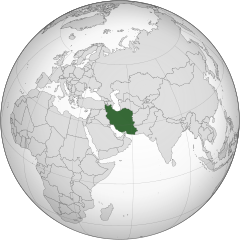
| Décripchon |
English: Iran
فارسی: ایران |
||||
| Date | |||||
| Source |
Traval parsonnel (Original text: Own work,)
|
||||
| Auteu | P30Carl | ||||
| Autres versions |
.svg)
|
||||
| SVG information |
.svg)
.svg)
.svg)
.svg)
.svg)
.svg)
.svg)
.svg)
.svg)
.svg)
.svg)
.svg)
.svg)
.svg)
.svg)
.svg)
.svg)
.svg)
.svg)
.svg)
.svg)
.svg)
.svg)
.svg)
.svg)
.svg)
.svg)
.svg)
.svg)
.svg)
.svg)
.svg)
.svg)
.svg)
.svg)
.svg)
.svg)
.svg)
.svg)
.svg)
.svg)
.svg)
.svg)
.svg)
.svg)
.svg)
.svg)
.svg)
.svg)
.svg)
.svg)
.svg)
.svg)
.svg)
.svg)
.svg)
.svg)
.svg)
.svg)
.svg)
.svg)
.svg)
.svg)
.svg)
.svg)
.svg)
.svg)
.svg)
.svg)
.svg)
.svg)
.svg)
.svg)

.svg)

.svg)

.svg)
.svg)
.svg)
.svg)
.svg)
.svg)
.svg)


.svg)
.svg)
.svg)
.svg)
.svg)
.svg)
.svg)

.svg)
.svg)
.svg)
.svg)
.svg)
.svg)
.svg)
.svg)
.svg)

.svg)
.svg)
.svg)
.svg)
.svg)
.svg)
.svg)
_without_national_boundaries.svg)
.svg)
.svg)
.svg)
.svg)
.svg)
.svg)

.svg)
.svg)
.png)
.svg)
.svg)
.svg)
.svg)

.svg)
.svg)
.svg)
.svg)
.svg)
.svg)
.svg)
.svg)
.svg)
.svg)
.svg)

.svg)
.svg)
.svg)
.svg)
.svg)
.svg)
.svg)
.svg)
.svg)

.svg)
.svg)

.svg)
.svg)
.svg)
.svg)
.svg)
.svg)
.svg)
.svg)
.svg)
.svg)
.svg)
.svg)
.svg)
.svg)
.svg)
.svg)
.svg)
.svg)
.svg)
.svg)
.svg)
.svg)
.svg)
.svg)
.svg)
.svg)
.svg)
_-_Crimea_disputed.svg)
.svg)
.svg)
.svg)
.svg)
.svg)
.svg)
.svg)
.svg)
.svg)
.svg)
.svg)
_political.svg)
.svg)
.svg)
.svg)
.svg)
_-_Crimea_disputed_-_no_borders.svg)
.svg)
.svg)
.svg)
.svg)
.svg)
.svg)
.svg)
.svg)
.svg)
.svg)
.svg)

.svg)
.svg)
.svg)

.png)
.svg)
.svg)
.svg)
.svg)
.svg)
.svg)
.svg)
.svg)
.svg)
.svg)
.svg)
.svg)
.svg)
.svg)
.svg)
.svg)
.svg)
.svg)
.svg)
.svg)
.svg)
.svg)
.svg)
.svg)
.svg)
.svg)
.svg)
.svg)
.svg)
.svg)
.svg)
.svg)
.svg)
.svg)
.png)
.svg)
.svg)
.svg)
_(orthographic_projection).png)
.svg)
.svg)
.svg)
Licince
Moi, en tant que détenteur des droits d’auteur sur cette œuvre, je la publie sous les licences suivantes :
Ech fichié-lo il est disponibe slon chés térmes del licince Creative Commons Attribucion - Partage dins chés meumes Conditions 3.0 (poin transposée).
- Os ètes libe :
- éd partager – éd copier, distribuer pi transmète chole euve
- d’adapter – éd modifier chole euve
- Dsous chés condicions suivantes :
- patérnitè – Os d'vez donner chés informacions appropriées concernant l'auteu, fournir un loyen vers el licince, et indiquer si des modificacions ont tè foaites. Os povez foaire cha pèr tout moéyin raisonnabe, mais poin d'eune manière qui suggérerait qu’il vos soutienne o approuve l'utilisacion éq vos in foaites.
- partage à l’idintique – Si os modifiez, transformez, o os basez édseur chole euve, os d'vez distribuer vote contérbuchon dsous el meume licince o eune licince compatibe aveuc chole éd l'original.

|
Os avez l' pérmission d' copier, distribuer pi modifier chol documint slon chés térmes del GNU Free Documentation License vérsion 1.2 obin toute vérsion ultérieure publièe pèr el Free Software Foundation, sans sékcions inaltérabes, sans teske d' prumière pache d' couvérture pi sans teske ed darène pache d' couvérture. Un egzimploère del licince est inclus dins l' sékcion intitulée GNU Free Documentation License. |
Vous pouvez choisir l’une de ces licences.
| Annotations | This image is annotated: View the annotations at Commons |
Histoère dech fichié
Buke su eune date/heure pou vir ch'fichié conme il étoait ach momint-lo.
| Date/Tans | Tiote image | Diminsions | Uzeu | Fichié éd chés conmints | |
|---|---|---|---|---|---|
| courant | 16 ed Marche 2015 à 23:32 | | 553 × 553 (291 kio) | Flappiefh | Removed Somaliland and Kosovo. Separated Western Sahara and Morroco. |
| 4 d'Aout 2013 à 12:27 |  | 553 × 553 (295 kio) | Flappiefh | Added South Sudan. | |
| 30 d'Aout 2009 à 08:03 |  | 541 × 541 (749 kio) | P30Carl | {{Information |Description={{en|1=Iran}} {{fa|1=ایران}} |Source=Own work, {{Inkscape}}<br />[http://www.aquarius.geomar.de/omc/make_map.html Aquarius.geomar.de]<br />{{GFDL-GMT|migration=redundant}} |Author=P30Carl |Date=August 2009 |
Usage dech fichié
Autchune pache n'est loïée aveuc ch'fichié-lo
Usage global du fichier
Chés eutes wikis suivants uzette chole fichier :
- Utilisacion édseur ady.wikipedia.org
- Utilisacion édseur af.wikipedia.org
- Utilisacion édseur ami.wikipedia.org
- Utilisacion édseur arc.wikipedia.org
- Utilisacion édseur ar.wikipedia.org
- إيران
- الدولة البهلوية
- ملوك فارس وإيران
- توقيت إيران
- قائمة الدول ذات السيادة والأقاليم التابعة في آسيا
- الحكومة الإيرانية المؤقتة
- قرار مجلس الأمن التابع للأمم المتحدة رقم 1696
- مستخدم:Alhassan Ehab/ملعب
- مستخدم:جار الله/قائمة صور مقالات العلاقات الثنائية
- العلاقات الأنغولية الإيرانية
- العلاقات الإيرانية الكورية الجنوبية
- العلاقات الإريترية الإيرانية
- العلاقات الإيرانية السويسرية
- العلاقات الإيرانية الليختنشتانية
- العلاقات الإيرانية البوليفية
- العلاقات الإيرانية الموزمبيقية
- العلاقات الألبانية الإيرانية
- العلاقات الإيرانية البلجيكية
- العلاقات الإثيوبية الإيرانية
- العلاقات الإيرانية البيلاروسية
- العلاقات الإيرانية الطاجيكية
- العلاقات الإيرانية الرومانية
- العلاقات الأرجنتينية الإيرانية
- العلاقات الإيرانية الغامبية
- العلاقات الإيرانية القبرصية
- العلاقات الإيرانية السيراليونية
- العلاقات الإيرانية النيبالية
- العلاقات الإيرانية الليبيرية
- العلاقات التشيكية الإيرانية
- العلاقات الإيرانية الميانمارية
- العلاقات الإيرانية الكندية
- العلاقات الإيرانية الزيمبابوية
- العلاقات الإيرانية البالاوية
- العلاقات الإيرانية المالية
- العلاقات الإيرانية النيجيرية
- العلاقات الإيرانية الفانواتية
- العلاقات الغابونية الإيرانية
- العلاقات الإيرانية البنمية
- العلاقات الإيرانية الكوبية
- العلاقات الإيرانية الجورجية
- العلاقات الإيرانية التونسية
- العلاقات الإيرانية الكورية الشمالية
- العلاقات الهندية الإيرانية
- العلاقات اليابانية الإيرانية
- العلاقات الإيرانية الإيطالية
- العلاقات الإيرانية الناوروية
Vir davantage édseur l’utilisacion globale éd chole fichié-lo.
.svg)
.svg)