Fichier:Map of Quebec-fr.png
Taille éd chl' apérchu : 569 × 600 pixels. Eutes résolucions : 228 × 240 pixels | 455 × 480 pixels.
Fichier d’origine (800 × 843 picséls, diminchon dech fichié: 1,02 Mio, MIME tipe: image/png)
| Décripchon |
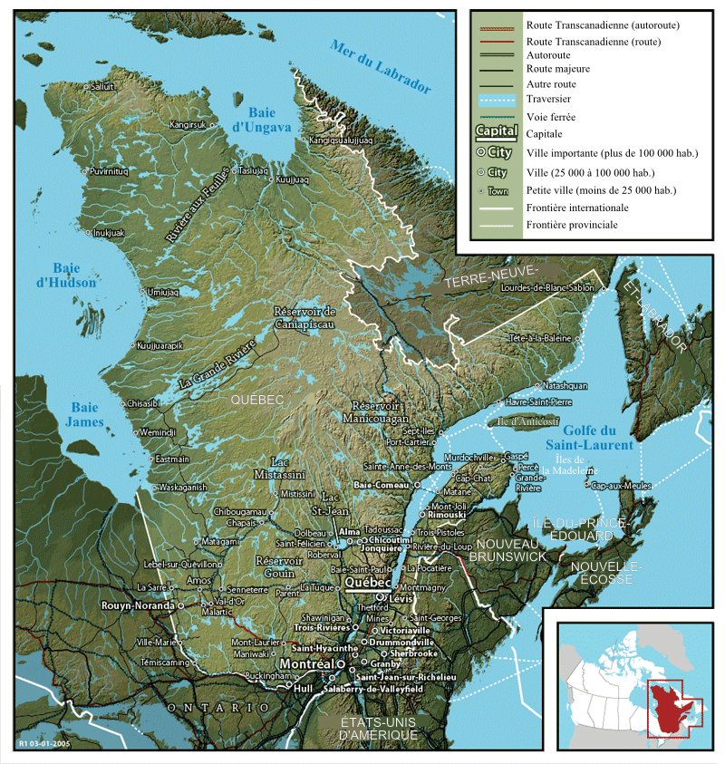
Français : Carte du Québec English: Map of Québec |
||
| Date | 6 d'Aout 2007 (date de téléversement) | ||
| Source | Image:Map of Quebec.png created by John Fowler, who released the image to the public domain. | ||
| Auteu | Modification by historicair 07:47, 6 August 2007 (UTC) / Translation by Boréal | ||
| Pérmission (Réutilisacion éd chole fichier) |
|
||
| Autres versions |
Français : Version anglaise Image:Map of Quebec.png English: English version Image:Map of Quebec.png |
Histoère dech fichié
Buke su eune date/heure pou vir ch'fichié conme il étoait ach momint-lo.
| Date/Tans | Tiote image | Diminsions | Uzeu | Fichié éd chés conmints | |
|---|---|---|---|---|---|
| courant | 6 d'Aout 2007 à 07:47 | | 800 × 843 (1,02 Mio) | Historicair | {{Information |Description={{fr}}Carte du Québec (1941) {{en}}Map of Québec |Source=Image:Map of Quebec.png created by John Fowler, who released the image to the public domain. |Date=06/08/2007 |Author=Modification by ~~~~ |
Usage dech fichié
L'pache d'apreu est loyée à ch'fichié-lo :
Usage global du fichier
Chés eutes wikis suivants uzette chole fichier :
- Utilisacion édseur de.wikipedia.org
- Utilisacion édseur fr.wikipedia.org
- Utilisacion édseur hr.wikipedia.org
- Utilisacion édseur mg.wikipedia.org
- Utilisacion édseur sr.wikipedia.org
- Utilisacion édseur sw.wikipedia.org